Discover the world’s most comprehensive collection of disaster-related data in our Global Data Catalog. Covering all types of hazards—both historical and contemporary—our extensive holdings provide critical insights for understanding and mitigating disaster risks. From direct observational data gathered by satellites, ocean buoys, and other measuring devices to infrastructure and demographic information that reveals the vulnerabilities of areas under threat, our catalog offers unmatched depth and breadth. Additionally, advanced hazard modeling data, such as earthquake intensity zones and tropical cyclone heat potential, empowers you to predict and prepare for the severity of potential hazards. With this robust dataset, you’ll gain the knowledge needed to make informed, proactive decisions.

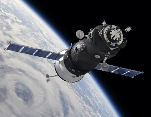
Our hazard data offers a unified model for 28 hazard types, covering both natural and manmade events on a global scale. With automated processing, we minimize latency from the moment an event occurs to when it becomes actionable data for our customers. Sourced from direct observations, such as satellite imagery, and reports from authoritative agencies worldwide, our data ensures accuracy, reliability, and a complete view of hazards as they unfold.
Our Uniform Data Model transforms diverse data from a wide variety of sources and hazard types into a single, consistent schema. This simplifies complex information, allowing customers to easily understand the impacts of events without needing expertise in specific hazard types. The model includes detailed geometries to spatially describe affected areas, along with comprehensive reports on exposed populations and critical infrastructure. Designed for clarity and integration, our data model enables seamless use within your own applications and systems.
Our Exposure Modeling provides precise geometries that define the areas affected by a hazard, each labeled with a severity designation for potential impact. These areas are calculated using advanced, hazard-specific algorithms developed by our applied science team, ensuring accuracy and reliability. The geometries are continuously updated with each significant change to the hazard, delivering real-time insights. Available through both our applications and data feeds, this information empowers you to assess risks and take action with confidence.
Gain access to a vast array of observational data, including global wind speeds, rainfall accumulation, wave heights, sea and air temperatures, cloud coverage, wildfire hotspots, and more. Whenever possible, this data is enhanced with predictive insights to help you stay ahead of emerging risks. Sourced from trusted authoritative agencies, this data is seamlessly available through our DisasterAWARE application and can be provided via API upon request, offering flexibility to meet your specific needs

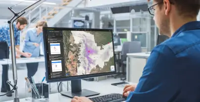
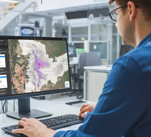
A powerful all-hazards early warning and risk intelligence platform that helps businesses monitor, assess, and respond to disasters in real time.

A free mobile app that delivers real-time hazard alerts and global risk intelligence, keeping you informed and prepared wherever you go.

Provides seamless access to global hazard data, enabling businesses to integrate real-time and historical disaster intelligence into their own applications and systems.