DisasterAWARE’s Data as a Service (DaaS) product delivers all-hazards global data developed through rigorous applied science. Designed for seamless integration, our data empowers organizations to enhance their applications and services with reliable, real-time hazard insights. From natural disasters to manmade events, our comprehensive datasets provide the foundation for informed decision-making, proactive risk management, and improved operational resilience.

This unified model simplifies data interpretation and ensures seamless integration into your systems, providing clear, actionable insights for every hazard.
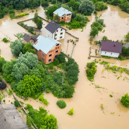
Examples of hazard-specific logic include wildfire perimeters, flood inundation zones, tropical storm wind fields, and earthquake shaking intensity. This detailed approach ensures organizations have the insights needed to understand and respond to potential impacts effectively.

DisasterAWARE combines data from authoritative agencies, such as NOAA, USGS, and federal governments, with applied science and advanced algorithms to fill gaps when official data is incomplete or delayed. This approach ensures all hazards are tracked comprehensively and accurately, even in challenging data environments. By blending trusted sources with scientific innovation, DisasterAWARE delivers a complete and reliable picture of every hazard, empowering organizations with the information they need to respond effectively.
This unified model simplifies data interpretation and ensures seamless integration into your systems, providing clear, actionable insights for every hazard.
Examples of hazard-specific logic include wildfire perimeters, flood inundation zones, tropical storm wind fields, and earthquake shaking intensity. This detailed approach ensures organizations have the insights needed to understand and respond to potential impacts effectively.
DisasterAWARE combines data from authoritative agencies, such as NOAA, USGS, and federal governments, with applied science and advanced algorithms to fill gaps when official data is incomplete or delayed. This approach ensures all hazards are tracked comprehensively and accurately, even in challenging data environments. By blending trusted sources with scientific innovation, DisasterAWARE delivers a complete and reliable picture of every hazard, empowering organizations with the information they need to respond effectively.


The Hazard API includes an Exposure Assessment that forecasts the potential impacts of hazards on populations, infrastructure, and economic assets. Using high-resolution demographic and infrastructure databases, the assessment provides:
The report delivers totals and breakdowns by severity level, offering actionable insights to support disaster response, resource allocation, and risk mitigation efforts.